Please note that as of Friday, March 20, 2020, Southeastern
Outings DOES plan to conduct all of its upcoming currently scheduled
events. However, we have developed a
statement of participant precautions as a result of the Covid 19 Corona
virus. Those precautions are described
in the statement below.
Notice
of Precautionary Measures Concerning Covid 19 Virus
Southeastern Outings assures all our outings
participants that we strongly desire to protect your health during this
critical time. You may make your own
decisions about what to do to protect yourselves, but the following measures
are what we strongly suggest. We
recommend taking the following measures.
We ask our participants to maintain a
reasonable social distance, usually 6 or more feet, between yourself and other
people. We recognize that this may not
always be possible, but we encourage you to keep some distance from others as
much as possible.
We encourage all our people coming on outings
with us to drive from the meeting place to the outing start point in the same
vehicle in which they arrived at the meeting place. A few people may ride from the meeting place with drivers who
came to the meeting place alone, but we recommend that such arrangements be
limited to no more than two people in a vehicle. Naturally if more than one person arrives at the meeting place in
a given vehicle, then all the people in that vehicle may ride together in that
same vehicle from the meeting place to the hike start point.
One or two persons will be designated to sign
everyone in so that clipboards and pens are not shared by everyone on the
outing.
We will have outing announcements, but we ask
you to try insofar as possible to maintain a distance of six feet between
yourself and others while the announcements are given. Dan will try to project his voice
effectively in such instances, and please, please do not converse with others
while announcements are being made.
In some instances when we have more than ten
participants coming on an outing, we may split the group up into two parties
with two different leaders. Everyone
will go to the same places during the outing, but we may want to reduce the
number of people hiking together in the same group. These decisions will be made on a case by case or event by event
basis.
Optional restaurant dinners will be cancelled
until further notice.
We want to point out that walking in the woods
where there are not many other people present is considerably safer at this
time than walking in crowds of people or in heavily populated public
places.
MARCH
7, SATURDAY, Meet 9:15 a.m.
Moderate
Dayhike
Porter’s
Gap on the Pinhoti Trail

Details: The Pinhoti is Alabama's long distance trail. The
existing trail runs approximately 139 miles from the Tramel trailhead near
Sylacauga to the High Rocks trailhead east of Piedmont near the Georgia line.
We plan to hike a rather tame portion of the Pinhoti to the east of Talladega
County's Porter’s Gap. We'll climb through pretty Alabama hardwoods on a gentle
trail for an elevation gain of about 600 feet over almost 2 miles. Gaining the
ridge top we'll be in interesting rock formations with partially obscured views
off the Talladega Mountain Ridge to the north and Shin Bone Ridge and Lizard
Scrape Mountain to the south. We will eat lunch there. We will return the same
way we came up.
Please
bring water and your picnic lunch.
Optional
restaurant dinner after the hike.
Please
meet 9:15 a.m. at the Leeds Highway 78 gravel parking
lot. We plan to depart from there at 9:30 a.m. Bring a friend or friends.
MARCH 8, SUNDAY, Meet 12:45 p.m.
Second Sunday Dayhike in Oak Mountain
State Park

Details: Enjoy a moderate 4-mile walk in the woodlands near Birmingham
on a Sunday afternoon. This is an
excellent outing for introducing your friends to Southeastern Outings and for
making new friends who enjoy the outdoors.
Parts of this hike may be off the color-coded trails. There will be some ups and downs.
Well-behaved,
properly supervised children age eight and up able to walk the distance of
about 4 miles without complaining and complete the hike are welcome.
Share
an adventure! Bring a friend.
Please meet at
12:45 p.m. in the Oak Mountain
Park office parking lot. We plan to
depart from there at 1:00 p.m.
Please
bring $5/person ($2.00 seniors) park admission fee plus your drink.
Info: Randall Adkins, 205/317-6969
MARCH 12, THURSDAY, Meet 9:15 a.m.
Weekday Hike
Where: High
Ore Line Trail in Birmingham and Midfield, Alabama

Details: This
will be Southeastern Outings first ever hike on this relatively new in-city
trail. The hike, which is rated easy,
will be 3 miles long with very little change in elevation.
Birmingham’s three-mile High Ore Line Trail is now complete and
open to the public. We will start our
hike on the High Ore Line Trail at Red Mountain Park’s new entrance and parking
lot on Venice Road and hike along an old railroad line to the Jefferson County
Western Health Center in Midfield. The trail is mostly flat and off road and
provides an accessible place to walk or bike in Greater Birmingham’s
outdoors.
In 2012, the City of Birmingham won a competitive Department of
Transportation TIGER grant for $10,000,000 in order to develop active
transportation routes in Birmingham. With this funding, the City of Birmingham,
Freshwater Land Trust, Jefferson County Health Department, and many partners
have built 14 trail miles throughout Birmingham. The first two miles of the High Ore Line Trail opened in 2016. With its third and final mile complete, High Ore Line now
connects Red Mountain Park to Jefferson County’s growing Red Rock Trail System.
“We are thrilled to open this new portion of High Ore Line and
hope it will continue to be a valuable asset to the community,” said Carolyn
Buck, Freshwater Land Trust Red Rock Trail Director. “With each trail opening, we are one step closer to our goal of
building and connecting 750 miles of trails in Jefferson County.”
“We are excited to celebrate this long-anticipated connection to
Red Mountain Park as it creates more opportunities for more communities in
Birmingham to engage in outdoor recreation and learn about our shared
history,” said T.C. McLemore, Red Mountain Park Executive Director.
In Midfield, an industrial suburb of Birmingham near the towering
U.S. Steel plant, a railroad track once sliced through the air, an elevated
track running ore and coal from the mines at Red Mountain to the steel works at
Fairfield. Today, decades after the railroad went out of operation, the
elevated track has a new lease on life: a green one.
Spanning three miles from
Midfield to Venice Road at the base of Red Mountain, the High Ore Line Trail
now occupies the raised railroad line as one of the newest additions to the Red
Rock Ridge and Valley Trail System. Connecting neighborhoods in west Birmingham
to Midfield, the trail passes its visitors over Valley Creek with a glimpse in
the distance of Red Mountain Park – to which the trail is now connected. It is a space of recreation and peace, a
place where a simple stroll can become a scenic experience blending the urban
industrial suburbs with natural, preserved greenspace.
As greenspaces around Birmingham help the Magic City make a
resurgence, the High Ore Line Trail is a project that makes sure the western
neighborhoods of Birmingham get their own piece of the puzzle.
Please
bring water to drink and comfortable footwear suitable for walking three
miles. We expect to complete the hike
before lunch time.
Please
meet 9:15 a.m. at the new Jones Valley parking lot for Red Mountain Park, 2109
Venice Road, Birmingham, Alabama. We
plan to depart from there at 9:30 a.m.
Information and Trip Leader: Francis Rushton, 205-290-5557
CORRECTED DIRECTIONS TO MEETING PLACE
Red Mountain Park Jones Valley parking lot, 2109 Venice
Road, Birmingham, Alabama 35211-- Take I-65 to the Lakeshore
Parkway Exit, Exit number 255. At end of the exit ramp turn left onto
Lakeshore Parkway if coming from Hoover. Turn right onto Lakeshore
Parkway if coming from downtown Birmingham. Drive 4.7 miles on Lakeshore
Parkway to intersection with Venice Road on the right and Shannon-Wenonah Road
on the left. Turn right onto Venice Road. Drive 1.3 miles on
Venice Road. See High Ore Line Trail on the left and driveway for Jones
Valley Parking Lot for Red Mountain Park on the right. There is no sign
for Red Mountain Park there, but there is a very prominent pedestrian crosswalk
painted on the road you are on and a pedestrian crossing sign on the right of
the road at that intersection. Turn right there and drive into the Jones
Valley Parking Lot for Red Mountain Park and park there. This is the
meeting place for our hike on the High Ore Line Trail.
MARCH 14, SATURDAY, Meet 9:45 a.m.
Dayhike
Where: Horseshoe
Bend National Military Park

Click for More Pictures
Details: On March 27, 1814, Major General Andrew Jackson‘s army of 3,300 men attacked Chief Menawa’s 1,000 Red Stick Creek warriors fortified in a horseshoe- shaped bend of the Tallapoosa River. Over 800 Red Sticks died that day. The battle ended the Creek War, resulted in a land cession of 23,000,000 acres to the United States and created a national hero of Andrew Jackson.
In
March 1814, General Jackson's army left Fort Williams on the Coosa River, cut a
52-mile trail through the forest in three days, and on the 26th made camp six
miles north of Horseshoe Bend. The next morning, Jackson sent General John Coffee
and 700 mounted infantry and 600 Cherokee and Creek allies three miles
down-stream to cross the Tallapoosa and surround the bend. He took the rest of
the army - about 2000 men, consisting of East and West Tennessee militia and
the Thirty-ninth U.S. Infantry - into the peninsula and at 10:30 a.m. began an
ineffectual two-hour artillery bombardment of the Red Sticks' log barricade. At
noon, Coffee's Cherokee allies crossed the river and assaulted the Red Sticks
from the rear. Jackson quickly ordered a frontal bayonet charge, which poured
over the barricade. Fighting ranged over the south end of the peninsula
throughout the afternoon. By dark at least 800 of Chief Menawa's 1,000 Red
Sticks were dead (557 slain on the field and 200-300 in the river). Menawa himself,
although severely wounded, managed to escape. Jackson's losses in the battle
were 49 killed and 154 wounded, many mortally.
Though
the Red Sticks had been crushed at Tohopeka, remnants of the war party held out
for several months. In August 1814, a treaty between the United States and the
Creek Nation was signed at Fort Jackson near the present day city of Wetumpka,
Alabama. The Treaty of Fort Jackson ended the conflict and required the Creeks
to cede 23 million acres of land to the United States. The state of Alabama was
carved out of this domain and admitted to the Union in 1819.
In
1828, partly as a result of his fame from the battles of Horseshoe Bend and New
Orleans, Andrew Jackson was elected the seventh President of the United States.
We will
have the opportunity to watch a short film and view the exhibits before we
begin our hike which is rated easy.
Hike distance is 5.8 miles.
Admission
to the park is free.
Well-behaved, carefully supervised children
age eight and over welcome. Optional restaurant
dinner after the hike.
Please
meet 9:45 a.m. at the Publix in The Village at Lee Branch in Greystone. We
plan to depart from there at 10:00 a.m.
Info: Randall
Adkins, 205/317-6969
MARCH 21, SATURDAY, Meet 9:45 a.m.
Dayhike
Where: Piper
Interpretive Trail, Cahaba National Wildlife Refuge, Piper (near West Blocton),
Alabama

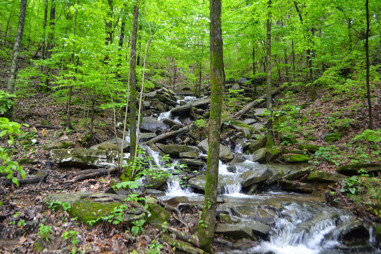
Details: The Piper Interpretive Trail is a 2.8-mile, lightly trafficked trail in the Cahaba National Wildlife Refuge located near Piper, Alabama. The trail features a river and is good for all skill levels. The trail is primarily used for hiking, walking, nature trips, and bird watching and is accessible year-round.
This well-maintained trail goes through the forest and ends with a deck
overlooking the Cahaba River. The trail passes some interesting ravines and
cliffs. If you continue onward after the first overlook, you will reach a
second overlook, which is slightly more difficult to reach, due to elevation
changes.
The first half of the trail is an old mine railroad right of way along a
rocky ridgeline high above the Cahaba River.
A stand of pine,
mostly loblolly planted to replace the longleaf pines that were clearcut years
ago, make for a beautiful canopy and visually appealing section of the
trail—the fallen needles provide soft footing and make the peaceful forest even
more quiet. There
are scenic overlooks of the river and an opportunity to climb down to the
riverside if you're ambitious.
At mile 1.2,
you will find a side trail off to the right that leads steeply downhill to the
first overlook. After enjoying
the view, you will cross a second bridge over a seasonal stream. From there the
trail climbs up the ridge on a rocky old mining road to the final overlook. From the platform you can see the Cahaba
River far below.
We may also walk in the woods along the Cahaba River above the Piper
Bridge. We will definitely walk on some newer trails which turn off of the road
in the part of Cahaba National Wildlife Refuge across the river from the Piper
Trail.
Children age 9 and older
welcome.
Meet 9:45 a.m. at the
McDonald’s Galleria parking lot. We
plan to depart from there at 10:00 a.m.
Rescheduled to March 29th
MARCH 22, SUNDAY, Meet 1:45 p.m.
Wildflower Walk in a Forest Preserve in
Homewood
Details: The City of Homewood owns two forest preserves on
Shades Mountain adjacent to the Homewood High School. Come and spend a relaxing two hours walking and admiring wildflowers
with us in the lower preserve. Rated
moderately easy. Well-behaved,
carefully supervised children age 6 and older welcome.
Please
meet 1:45 p.m. in
the Homewood High School east (nearest Brookwood Village Shopping Center)
parking lot, just off Lakeshore Drive in Homewood. We plan to depart
from there at 2:00 p.m.
MARCH 28, SATURDAY, 8:15 a.m.
Southeastern Outings Wildflower Walk
Where: Bucks Pocket State Park

Details: Bucks Pocket State Park has one of the greatest
concentrations and variety of wildflowers of any public area in the State of
Alabama. Join fellow nature lovers for a walk on trails in this very
scenic park. We expect to have a
wildflower resource guide knowledgeable in wildflower identification to hike
with us on this outing.
In
the morning we’ll first drive to visit High
Falls. This is a spectacular, large
volume waterfall. We’ll have our picnic
lunch at High Falls Park. Then we’ll
drive a short distance to Bucks Pocket State Park for an easy stroll on trails
in this very scenic park. We’ll start
at the overlook and walk slowly down to the canyon floor. Along the way we’ll stop by
and view two lovely waterfalls. After
that part of the hike in Bucks Pocket State Park, we’ll cross the creek and see
even more wildflowers as we walk on a trail through the woods heading upstream
beside the creek to a third waterfall.
Total
walking distance in Bucks Pocket State Park is about 5 miles. Hike rated moderate. Well-behaved, properly supervised children
age 7 and up able to walk five miles without complaining welcome.
Please meet at 8:15 a.m. at
the Food Giant parking lot in Pinson.
We plan to depart from there at 8:30 a.m.